
Fort Lauderdale International Boat Show Transit Map
Client: Show Management
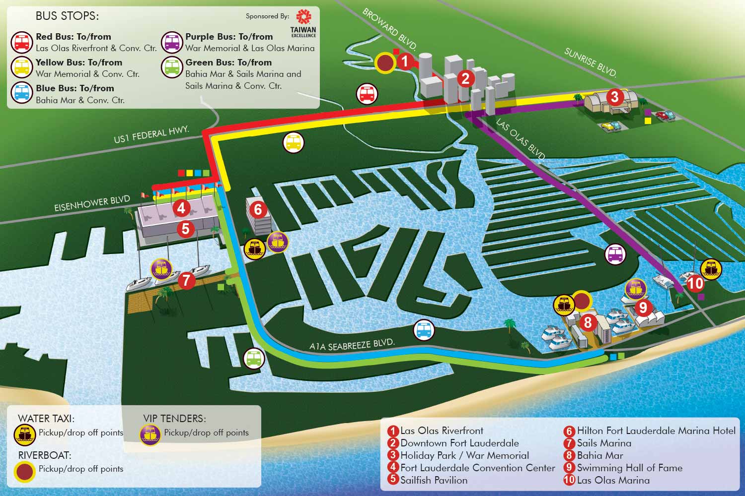
Fort Lauderdale International Boat Show Transit Map
This illustrated map was designed to streamline attendee transportation for the Fort Lauderdale International Boat Show. Its primary function is to clearly communicate the connections between the event's multiple venues, prioritizing intuitive wayfinding over precise geographical scale. The result is a practical and visually engaging guide to the show's transit network.
The map employs a distinct illustrative approach for quick recognition. Important venues and landmarks are depicted with stylized artwork, creating immediate visual cues. To organize the various transit options, a color coding system is used for different shuttle routes. Each color corresponds to a specific service, clearly explained in a map key positioned in the upper left corner for quick reference.
Water taxi stops are highlighted with their own dedicated set of icons, detailed in a separate key located in the lower left section of the map. Major destinations are marked with numbered red dots, accompanied by a corresponding list in the lower right. To aid in general orientation, key roadways are labeled directly on the illustration.
This project exemplifies how tailored illustration can effectively clarify complex logistical systems. By integrating a straightforward color coded framework with accessible artwork, the map successfully guides visitors through their transportation choices, contributing to a more efficient and positive event experience.
For more examples of functional illustration for events, please visit my Map Portfolio.
Fort Lauderdale International Boat Show Maps:
- About Fort Lauderdale International Boat Show
- Bahia Mar, Swimming Hall of Fame & Las Olas Marina Maps: 2025 | 2024 | 2023 | 2022 | 2020 | 2019 | 2018 | 2017 | 2016 | 2015 | 2014 | 2013 | 2012 | 2011 | 2010
- Parking and Transportation Maps: 2025 | 2024 | 2023 | 2022 | 2020 | 2019 | 2018 | 2015 Bus | 2015 Water Taxi | 2014 | 2013 | 2012 | 2011
- Broward County Convention Center Maps: 2025 | 2024 | 2023 | 2022 | 2017 Sailfish Pavilion | 2017 | 2016 Sailfish Pavilion | 2016 | 2015 Sailfish Pavilion | 2015 | 2014 Sailfish Pavilion | 2014 | 2013 Sailfish Pavilion | 2013 | 2012 | 2011 | 2010
- Marinas Maps: 2025 | 2024 | 2023 | 2022 | 2019 | 2016
- Program Layouts: 2025 | 2024 | 2023 | 2022
- Signs: 2013 looking north | 2013 Yachting Tent
- Video: 2013 54th Annual
- Illustrations (not maps): 2014A | 2014B


PORTFOLIOS
- Illustration Portfolio: Start here for custom illustration and book covers. You can also browse illustrated maps and architectural rendering.
- Fine Art: I offer original paintings and drawings, including my Custom Halftone Series. You will also find mural work here.
- Graphic Design & Motion: View my graphic design portfolio. After that, explore motion design and animated illustrations.
- Maps by application: I create illustrated maps for boat shows, resorts, marinas, real estate, transportation, transit and parking, towns and cities, parks, and wayfinding.
- Additional project types: I also produce cover illustration, vehicle and vinyl wraps, proposal renderings, and street art.
- Illustration methods: My techniques include vector, isometric and axonometric, painting, black and white, GeoData maps, overhead maps, and custom halftones.
- Software portfolios: I work primarily in Adobe Photoshop, Adobe Illustrator, SketchUp Pro, and Adobe InDesign. For motion projects, I use Premiere Pro and After Effects.