
Site Plan For a Big Boat Show as an Illustrated Map
Client: Show Management
For information about the Fort Lauderdale International Boat Show visit FLIBS.com
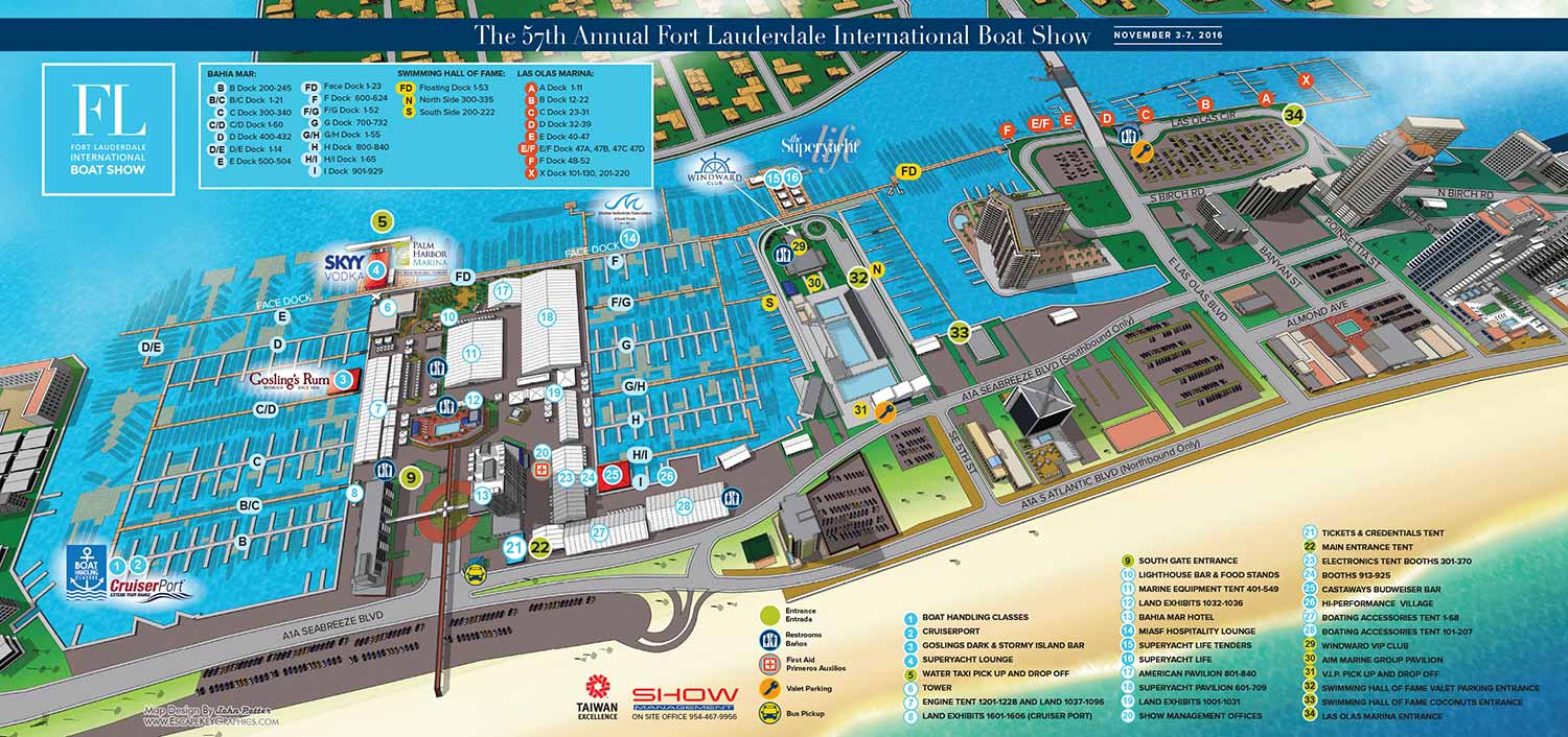
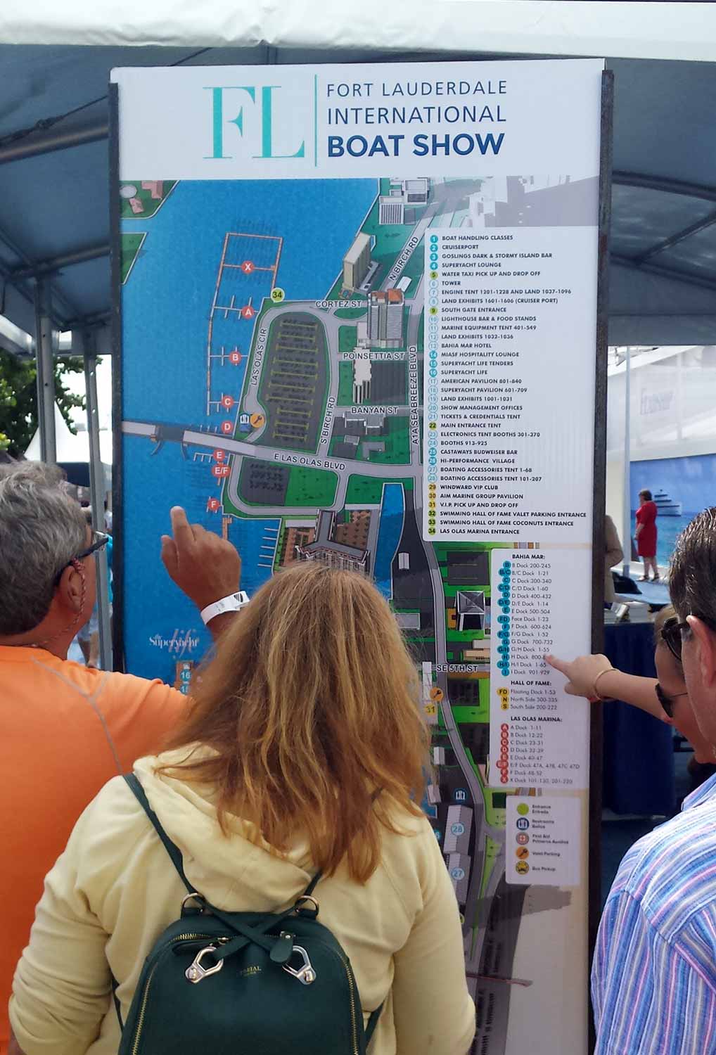
For the 2016 Fort Lauderdale International Boat Show, I continued my long standing role updating the illustrated site map covering Bahia Mar, Las Olas Marina, and the International Swimming Hall of Fame. This map functions as a primary navigation resource for one of the largest in water boat shows in the world, guiding thousands of attendees through a complex, multi venue waterfront setting.
Client: Showboats Magazine
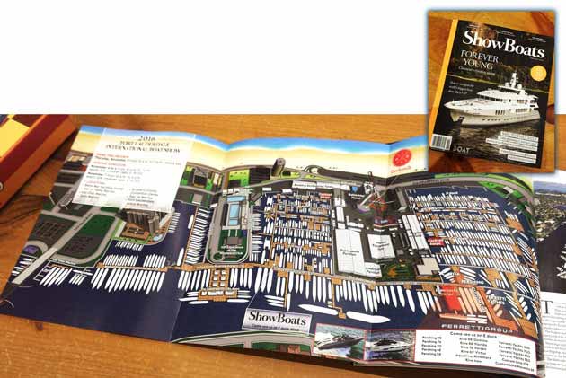
Each annual edition requires careful revision to reflect changes in the show layout. The 2016 map included significant updates to dock configurations, exhibitor locations, hospitality areas, and access points. Sponsor logos were reviewed and adjusted to ensure accurate placement and clear visibility throughout the illustration. From a design standpoint, the 2016 edition introduced a lighter, brighter color palette with reduced visual texture compared to the previous year. Subtle refinements were also made to the boat silhouettes, shifting to darker forms on lighter backgrounds to improve contrast and legibility.
To further enhance readability, docks are labeled with clear letter identifiers, land based features are keyed numerically, and shared amenities such as restrooms, services, and transportation points are represented through a consistent icon system. These design choices ensure the map performs effectively across a wide range of formats, including printed show guides, large format signage, mobile devices, and digital platforms. This project highlights the value of custom illustrated maps as both essential wayfinding tools and strong visual assets for large scale marine events.
Fort Lauderdale International Boat Show Maps:
- About Fort Lauderdale International Boat Show
- Bahia Mar, Swimming Hall of Fame & Las Olas Marina Maps: 2025 | 2024 | 2023 | 2022 | 2020 | 2019 | 2018 | 2017 | 2016 | 2015 | 2014 | 2013 | 2012 | 2011 | 2010
- Parking and Transportation Maps: 2026 | 2025 | 2024 | 2023 | 2022 | 2020 | 2019 | 2018 | 2015 Bus | 2015 Water Taxi | 2014 | 2013 | 2012 | 2011
- Broward County Convention Center Maps: 2026 | 2025 | 2024 | 2023 | 2022 | 2017 Sailfish Pavilion | 2017 | 2016 Sailfish Pavilion | 2016 | 2015 Sailfish Pavilion | 2015 | 2014 Sailfish Pavilion | 2014 | 2013 Sailfish Pavilion | 2013 | 2012 | 2011 | 2010
- 17th St Marinas Maps: 2026 | 2025 | 2024 | 2023 | 2022 | 2019 | 2016
- Show Directory Layouts: 2025 | 2024 | 2023 | 2022
- Video: 2013 54th Annual
- Illustrations (not maps): 2014A | 2014B


PORTFOLIO SELECTIONS
- Custom illustration & covers: Featuring bespoke illustration, book and magazine covers, hand-drawn maps, and building renderings.
- Fine art & murals: Including one-of-a-kind paintings and drawings, the Custom Halftone Series, and large-scale murals.
- Design & motion media: Covering graphic design, plus video and motion and animated illustration.
- Mapping by application: Tailored maps for marine events, hospitality, waterfront, property, transit, municipal, recreation, and navigation needs.
- Additional creative work: Includes editorial covers, vehicle graphics, concept renderings, and public art.
- Mediums & formats: Ranging from digital vector and isometric projection to traditional paint, line art, GIS-based, aerial-style, and halftone.
- Software expertise: Proficient in Photoshop, Illustrator, SketchUp, InDesign, and Premiere/After Effects for motion. More recently I have worked with AI.