Osborne Park Residential Park Map
For information on Osborne Residential Park please visit Tingdene-Parks.net
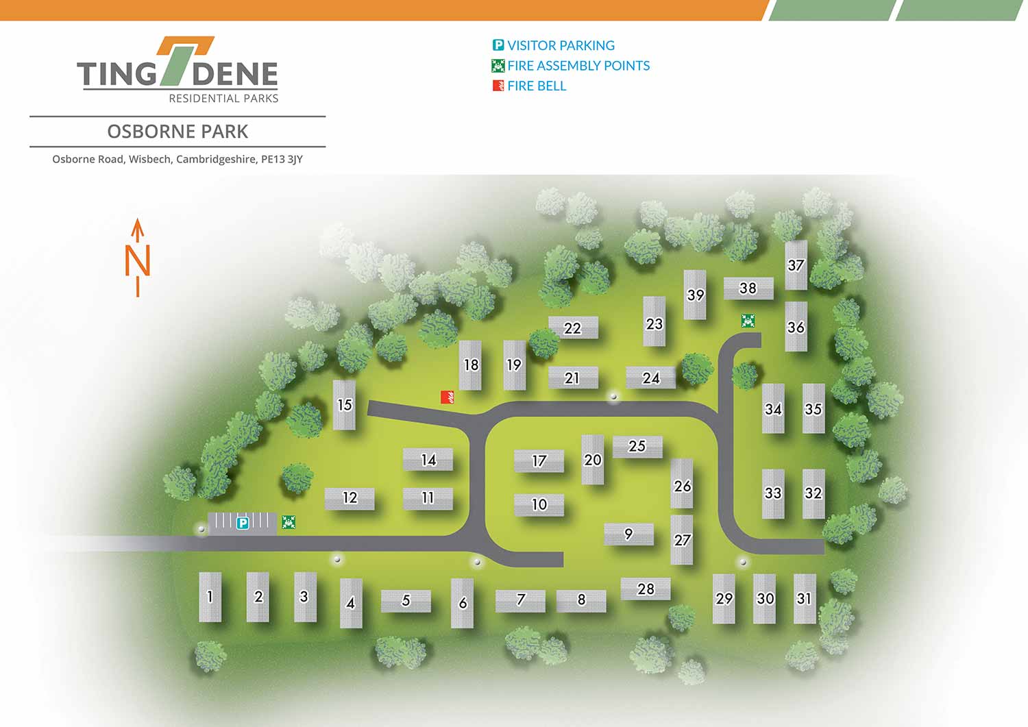
Osborne Park is a well presented residential park set within the attractive Cambridgeshire countryside, offering a peaceful setting with convenient access to nearby towns and local amenities. The location combines a sense of space and calm with everyday practicality, making it an appealing choice for those seeking a comfortable and well connected place to live. The park’s layout and surroundings contribute to a welcoming residential environment suited to year round living.
Escape Key Graphics created this illustrated overhead real estate map to clearly communicate the layout of the park and support straightforward navigation for residents, visitors, and prospective buyers. Individual plots are clearly numbered, allowing key information to be understood quickly without overcrowding the illustration. This considered approach ensures the map remains clear, legible, and practical for regular use.
Simple and consistent graphic icons are used to identify park amenities such as parking areas and the marketing suite. Designed to support both practical and promotional needs, the map works effectively as on site signage and general wayfinding, while also serving as a polished marketing asset. It presents the layout and features of Osborne Park in a professional and approachable manner, helping convey the character, setting, and overall appeal of the residential park to prospective residents.
WORK FOR TINGDENE MARINAS:


WORK FOR TINGDENE RESIDENTIAL PARKS:


WORK FOR TINGDENE - COMBINED MARINA AND RESIDENTIAL PARK MAPS:


REAL ESTATE MAPS:


RESORT MAPS:


PORTFOLIOS
- Illustration Portfolio: Start here for custom illustration and book covers. You can also browse illustrated maps and architectural rendering.
- Fine Art: I offer original paintings and drawings, including my Custom Halftone Series. You will also find mural work here.
- Graphic Design & Motion: View my graphic design portfolio. After that, explore motion design and animated illustrations.
- Maps by application: I create illustrated maps for boat shows, resorts, marinas, real estate, transportation, transit and parking, towns and cities, parks, and wayfinding.
- Additional project types: I also produce cover illustration, vehicle and vinyl wraps, proposal renderings, and street art.
- Illustration methods: My techniques include vector, isometric and axonometric, painting, black and white, GeoData maps, overhead maps, and custom halftones.
- Software portfolios: I work primarily in Adobe Photoshop, Adobe Illustrator, SketchUp Pro, and Adobe InDesign. For motion projects, I use Premiere Pro and After Effects.