Ashwood Park Residential Park Map
For information on Ashwood Residential Park please visit Tingdene-Parks.net
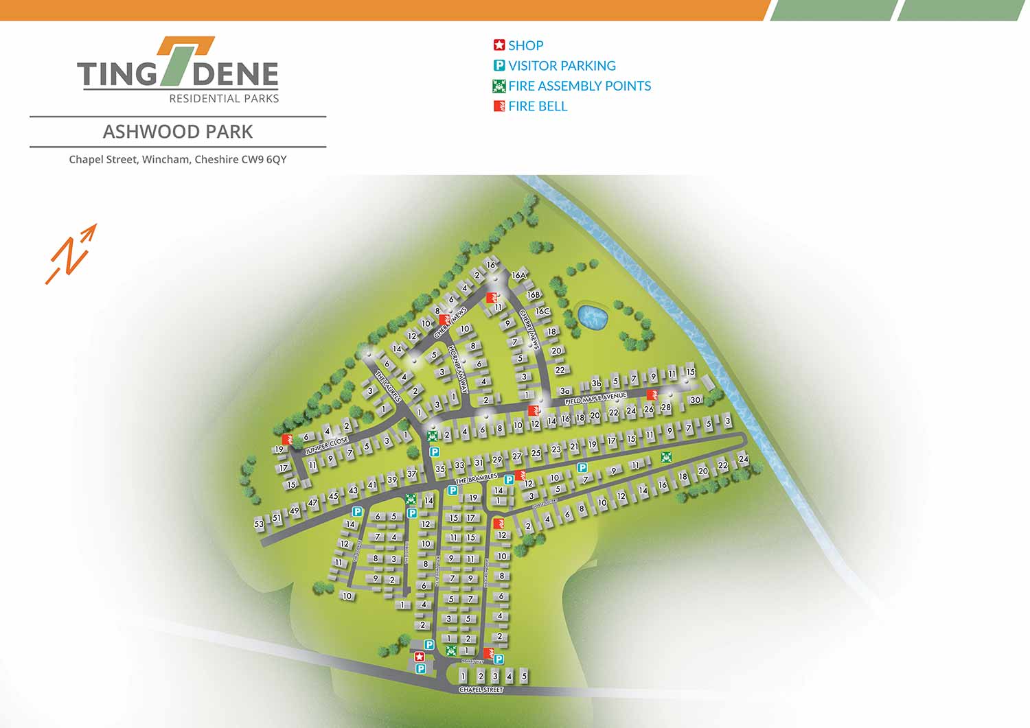
Set within the attractive Cheshire countryside and just two miles from the lively market town of Northwich, Ashwood Park enjoys a highly desirable location. Residents benefit from a peaceful rural setting alongside convenient access to a wide range of shops, leisure facilities, and local attractions, making the park one of the most appealing residential developments in the North West.
Escape Key Graphics created this illustrated overhead real estate map using a clean, vector based approach that allows the artwork to be scaled for both print and digital use without any loss of clarity. The illustration is intentionally restrained, using simple colour and minimal landscape detail to define the setting while keeping the layout easy to understand. Individual plots are numbered directly within the map, with street names clearly labelled to support straightforward navigation. Amenities such as the on site shop and visitor parking, along with essential safety features including fire bell points, are identified using a consistent system of clear graphic icons.
Designed to support both practical and promotional needs, the map functions as an effective orientation and wayfinding tool for residents and visitors. It also serves as a polished marketing asset, suitable for use online, on site signage, and for day to day park management, presenting Ashwood Park in a professional and welcoming manner.
WORK FOR TINGDENE MARINAS:


WORK FOR TINGDENE RESIDENTIAL PARKS:


WORK FOR TINGDENE - COMBINED MARINA AND RESIDENTIAL PARK MAPS:


REAL ESTATE MAPS:


RESORT MAPS:


PORTFOLIOS
- Illustration Portfolio: Start here for custom illustration and book covers. You can also browse illustrated maps and architectural rendering.
- Fine Art: I offer original paintings and drawings, including my Custom Halftone Series. You will also find mural work here.
- Graphic Design & Motion: View my graphic design portfolio. After that, explore motion design and animated illustrations.
- Maps by application: I create illustrated maps for boat shows, resorts, marinas, real estate, transportation, transit and parking, towns and cities, parks, and wayfinding.
- Additional project types: I also produce cover illustration, vehicle and vinyl wraps, proposal renderings, and street art.
- Illustration methods: My techniques include vector, isometric and axonometric, painting, black and white, GeoData maps, overhead maps, and custom halftones.
- Software portfolios: I work primarily in Adobe Photoshop, Adobe Illustrator, SketchUp Pro, and Adobe InDesign. For motion projects, I use Premiere Pro and After Effects.