Trowbridge Lodge Residential Park Map
For information on Trowbridge Lodge Residential Park please visit Tingdene-Parks.net
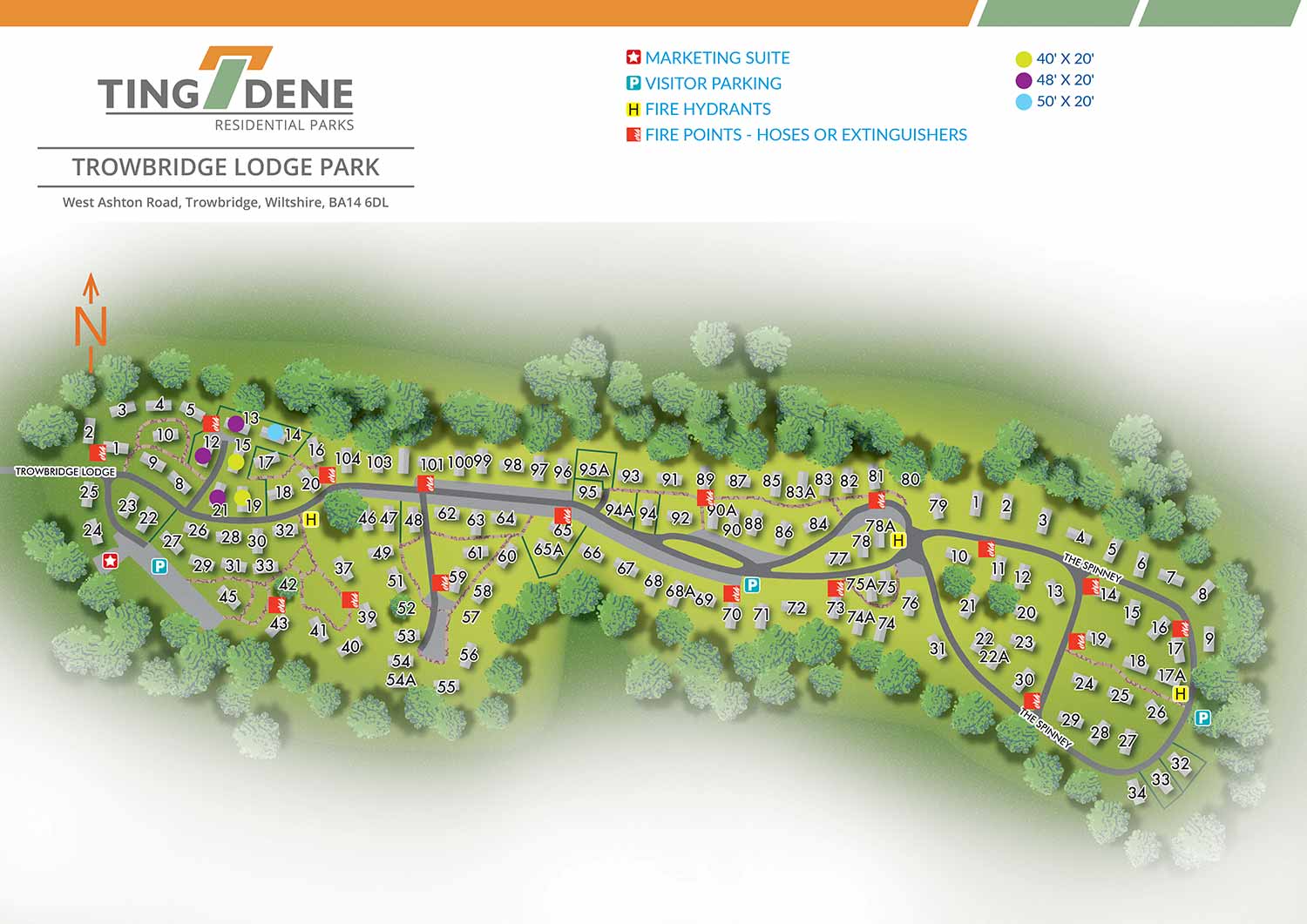
Set within the Wiltshire countryside, Trowbridge Lodge Residential Park offers a distinctive setting within the grounds of a former country estate. The park combines a peaceful rural atmosphere with convenient access to the nearby town of Trowbridge and surrounding amenities. Mature landscaping and open green spaces contribute to a sense of privacy and character, making the park an appealing choice for residential living.
Escape Key Graphics created this illustrated overhead real estate map using a clean and carefully considered vector based approach. The level of detail is intentionally controlled so the map remains visually engaging while clearly communicating the layout of the residential development. Individual plots are numbered directly within the illustration with roads clearly marked to support easy orientation for residents, visitors, and prospective buyers.
Amenities such as parking areas and the marketing suite are identified using simple and consistent graphic icons, alongside essential services including fire points. Using icons for recurring features helps maintain clarity and allows the map to be read quickly at a glance. Designed for both practical and promotional use, the map functions effectively as on site signage and general wayfinding, while also serving as a refined marketing asset that presents the layout and features of Trowbridge Lodge Residential Park in a professional and welcoming manner.
WORK FOR TINGDENE MARINAS:


WORK FOR TINGDENE RESIDENTIAL PARKS:


WORK FOR TINGDENE - COMBINED MARINA AND RESIDENTIAL PARK MAPS:


REAL ESTATE MAPS:


RESORT MAPS:


PORTFOLIOS
- Illustration Portfolio: Start here for custom illustration and book covers. You can also browse illustrated maps and architectural rendering.
- Fine Art: I offer original paintings and drawings, including my Custom Halftone Series. You will also find mural work here.
- Graphic Design & Motion: View my graphic design portfolio. After that, explore motion design and animated illustrations.
- Maps by application: I create illustrated maps for boat shows, resorts, marinas, real estate, transportation, transit and parking, towns and cities, parks, and wayfinding.
- Additional project types: I also produce cover illustration, vehicle and vinyl wraps, proposal renderings, and street art.
- Illustration methods: My techniques include vector, isometric and axonometric, painting, black and white, GeoData maps, overhead maps, and custom halftones.
- Software portfolios: I work primarily in Adobe Photoshop, Adobe Illustrator, SketchUp Pro, and Adobe InDesign. For motion projects, I use Premiere Pro and After Effects.