Oak Tree Park Residential Park Map
Client: Tingdene Residential Parks
For information on Oak Tree Residential Park please visit Tingdene-Parks.net
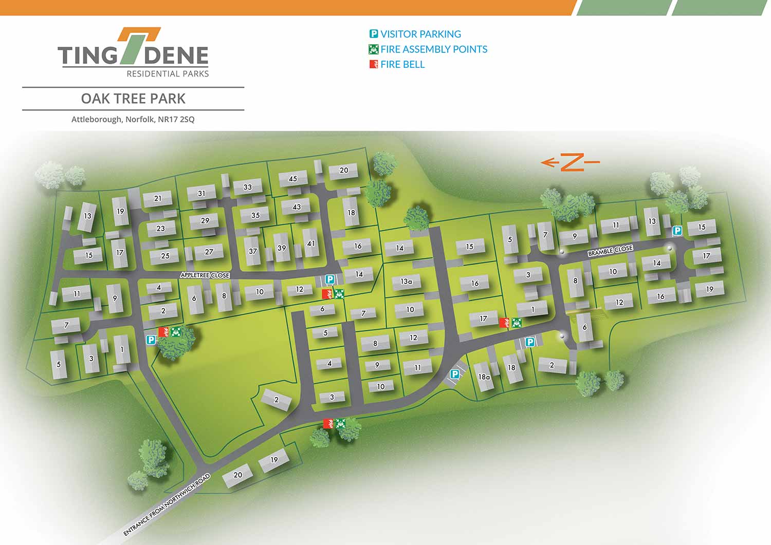
Oak Tree Residential Park is set in the tranquil Norfolk countryside, offering a peaceful environment for residents while remaining within easy reach of nearby towns and local amenities. The park combines a quiet rural setting with practical accessibility, providing an ideal location for those seeking a relaxed and welcoming community.
Escape Key Graphics created this illustrated overhead real estate map to clearly convey the layout of the park and support easy navigation for residents, visitors, and prospective buyers. Individual plots are clearly numbered, allowing key information to be understood quickly without overcrowding the illustration, ensuring the map remains clear and user friendly.
Simple and consistent graphic icons are used to identify park amenities, including parking areas and the marketing suite, alongside essential services such as fire assembly points. The use of recurring icons maintains clarity and readability, making the map an effective reference for everyday use.
Designed to support both practical and promotional needs, the map functions as on site signage and general wayfinding while also serving as a polished marketing asset. It presents the layout and features of Oak Tree Residential Park in a professional and approachable manner, helping prospective residents and visitors understand the park’s character, setting, and overall appeal.
WORK FOR TINGDENE MARINAS:


WORK FOR TINGDENE RESIDENTIAL PARKS:


WORK FOR TINGDENE - COMBINED MARINA AND RESIDENTIAL PARK MAPS:


REAL ESTATE MAPS:


RESORT MAPS:


PORTFOLIOS
- Illustration Portfolio: Start here for custom illustration and book covers. You can also browse illustrated maps and architectural rendering.
- Fine Art: I offer original paintings and drawings, including my Custom Halftone Series. You will also find mural work here.
- Graphic Design & Motion: View my graphic design portfolio. After that, explore motion design and animated illustrations.
- Maps by application: I create illustrated maps for boat shows, resorts, marinas, real estate, transportation, transit and parking, towns and cities, parks, and wayfinding.
- Additional project types: I also produce cover illustration, vehicle and vinyl wraps, proposal renderings, and street art.
- Illustration methods: My techniques include vector, isometric and axonometric, painting, black and white, GeoData maps, overhead maps, and custom halftones.
- Software portfolios: I work primarily in Adobe Photoshop, Adobe Illustrator, SketchUp Pro, and Adobe InDesign. For motion projects, I use Premiere Pro and After Effects.