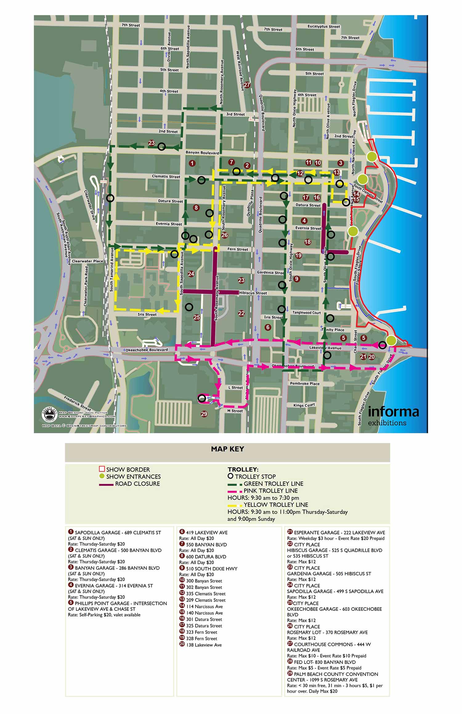
Transportation and Parking Map for the Palm Beach International Boat Show - 2019
For event information and to make sure you're seeing the latest map please visit the official site of the boat show.
If you are interested in hiring me to create an original map or illustration for you please contact me.

Maps For Palm Beach International Boat Show:
- Main Map: 2025 | 2024 | 2023 | 2022 | 2021 | 2020 | 2019 | 2018 | 2017 | 2016 | 2015 | 2014 | 2013| 2012 | 2011
- Transit & Parking Map: 2025 | 2024 | 2023 | 2022 | 2020 | 2018
- Program Layout: 2025 | 2024
- Video: 2013
OVERHEAD MAPS:
ABOUT THE PALM BEACH INTERNATIONAL BOAT SHOW:
This show features more than $1.2 billion worth of yachts and accessories, including hundreds of boats ranging from 8 foot inflatable boats to super yachts almost 300 feet long. It is considered one of the top five boat shows in the US. This show has a different vibe than the nearby Miami and Fort Lauderdale shows in that it's more quiet and less crazy and has easy parking and mass transit access. You can spend a few hours at The Palm Beach International Boat Show and also enjoy some local bars or restaurants. You can walk or take the trolley to City Place which is kind of West Palm Beach's entertainment district.
I illustrated the primary map for The Palm Beach International Boat Show every year from 2011 to present. In that time I changed the style, the software I use and changed things up to improve the map as the show has also grown. Even the format has changed. It used to be this really wide fold out thing. This has all taken place working closely with the staff of Show management which is now Informa. In addition to the primary map I illustrated maps for use in the phone app and signs. I also designed a transit map and a fold-able map for the show.


