Illustrated Map for Guests and Exhibitors
Client: Informa Markets
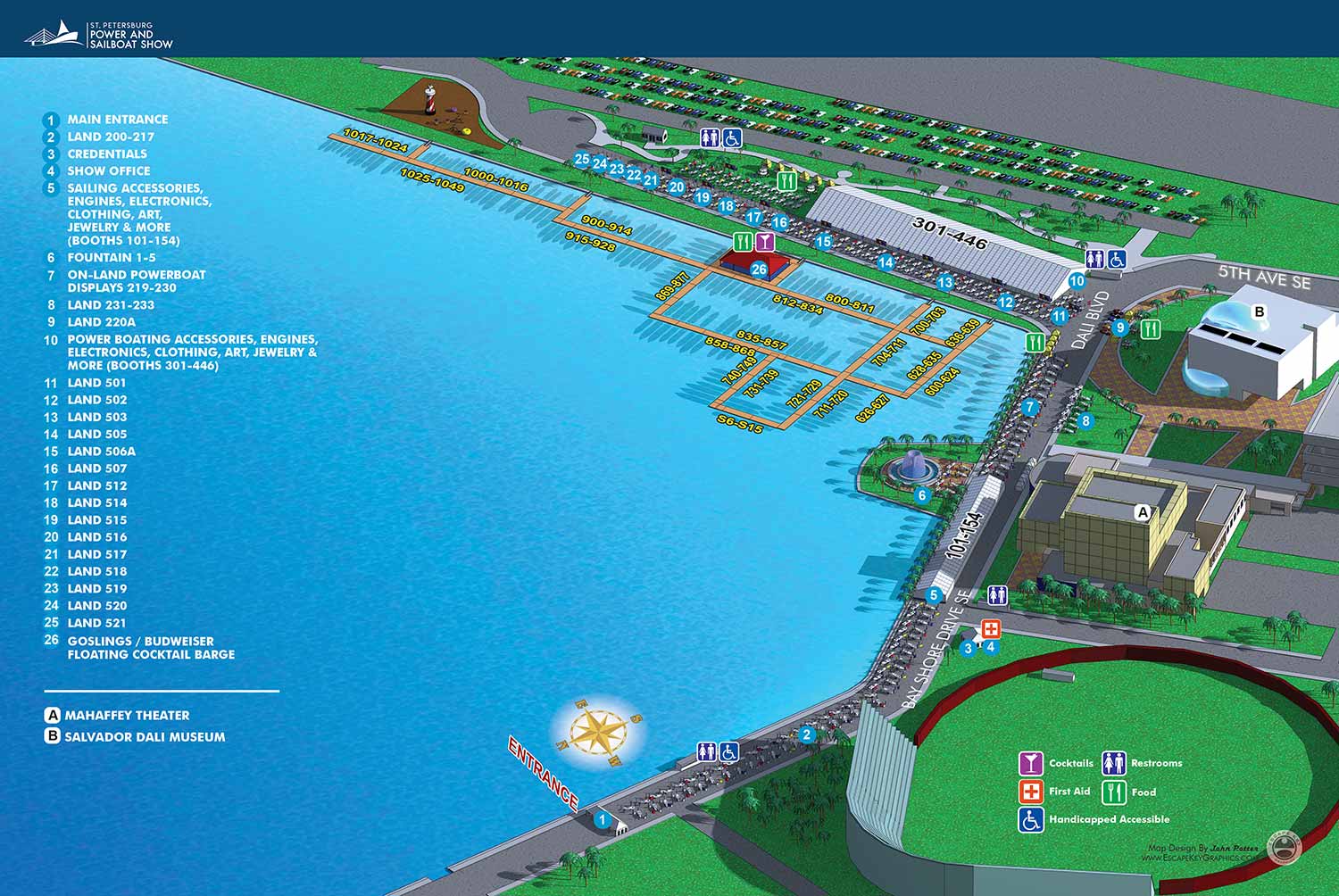
Following the necessary hiatus in 2020, the St. Pete Power and Sailboat Show returned in 2021. The map for the returning show did not require significant structural alteration—a practical approach that recognizes the value of a proven, effective design. A minimal need for major redesign is often the hallmark of a solid foundational layout, and returning visitors typically appreciate the comfort and intuitive ease of a familiar guide.
Illustration Process
The illustration was generated from the established three dimensional digital master model, which serves as the consistent geographic foundation for this event. The primary updates involved revising the model to reflect the current year's arrangements for floating docks and land based displays. The 3D model was rendered using SketchUp Pro and Kerkythea. The resulting renderings were then refined and prepared in Adobe Photoshop to achieve the final illustrative quality.
Graphic Design Integration
The informational graphics were layered onto the completed illustration. This involved the usual annual updates: the specific locations and corresponding text for points of interest were revised. The positions of the graphical icons for amenities were adjusted where necessary, though the icon key itself remained largely unchanged. The separate key identifying nearby buildings was carried over without alteration from the previous edition.
For more examples of my illustrative cartography for marine events, please visit my Maps Portfolio.
St. Petersburg Power & Sailboat Show Maps
- About St. Petersburg Power & Sailboat Show
- 2026 | 2025 | 2024 | 2023 | 2022 | 2021 | 2019 | 2018 | 2017 | 2016 | 2015 | 2014 | 2013 | 2012 | 2011


PORTFOLIOS
- Illustration Portfolio: Start here for custom illustration and book covers. You can also browse illustrated maps and architectural rendering.
- Fine Art: I offer original paintings and drawings, including my Custom Halftone Series. You will also find mural work here.
- Graphic Design & Motion: View my graphic design portfolio. After that, explore motion design and animated illustrations.
- Maps by application: I create illustrated maps for boat shows, resorts, marinas, real estate, transportation, transit and parking, towns and cities, parks, and wayfinding.
- Additional project types: I also produce cover illustration, vehicle and vinyl wraps, proposal renderings, and street art.
- Illustration methods: My techniques include vector, isometric and axonometric, painting, black and white, GeoData maps, overhead maps, and custom halftones.
- Software portfolios: I work primarily in Adobe Photoshop, Adobe Illustrator, SketchUp Pro, and Adobe InDesign. For motion projects, I use Premiere Pro and After Effects.