
Boat Show Map Site Plan Illustration
Client: Show Management
For information about the Fort Lauderdale International Boat Show visit FLIBS.com
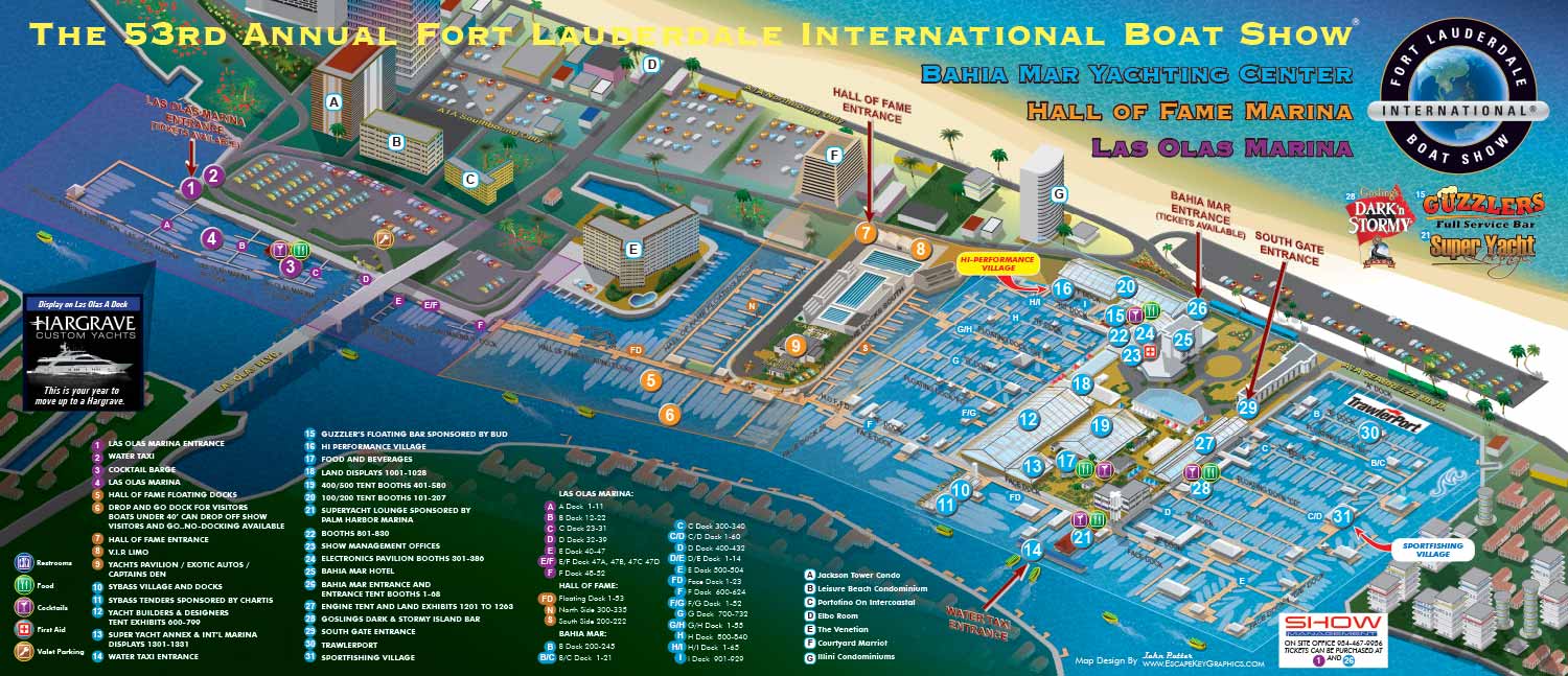
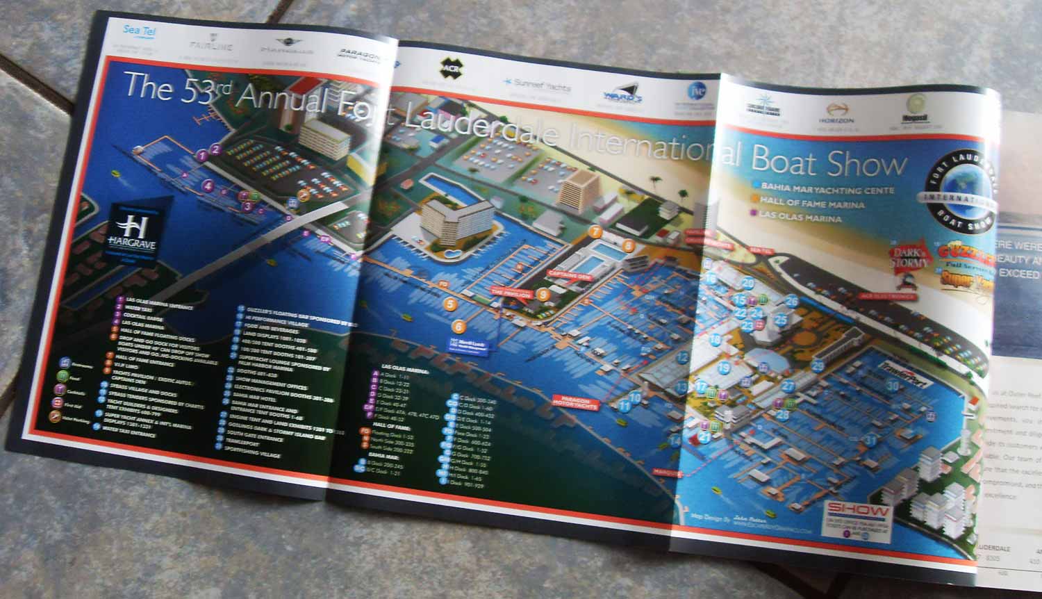
This illustrative site map was created for the 2012 Fort Lauderdale International Boat Show (FLIBS), continuing a collaborative relationship with one of the world's premier marine industry events. As the show evolves each year, so too must the official map that guides its many visitors through the sprawling network of docks, tents, and exhibits.
Client: Burgess Yachts

For this edition, the primary task was to provide accurate and clear updates reflecting the current year's layout. The essential updates involved revising the placement of docks and the keying of exhibitor locations within the various on land structures. These precise adjustments are critical, as they transform the map from a general illustration into a functional navigational tool for attendees, brokers, and exhibitors alike.
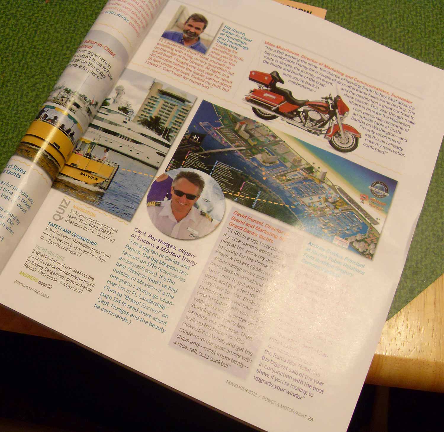
The established illustrative style, color coding, and overall visual language from the previous year were maintained to ensure immediate recognition and brand consistency. This approach allows returning visitors to intuitively understand the new map while appreciating its familiar, user friendly design. The final piece strikes a balance between artistic appeal and practical utility, serving as both a promotional image and an essential guide for navigating the extensive show grounds.
This project is part of an ongoing series. To view the map created for the previous year's event and see the progression of this work, please visit the 2011 FLIBS Map page.
For more examples of detailed illustrative cartography created for large scale events and venues, please explore my full Map Portfolio.
Fort Lauderdale International Boat Show Maps:
- About Fort Lauderdale International Boat Show
- Bahia Mar, Swimming Hall of Fame & Las Olas Marina Maps: 2025 | 2024 | 2023 | 2022 | 2020 | 2019 | 2018 | 2017 | 2016 | 2015 | 2014 | 2013 | 2012 | 2011 | 2010
- Parking and Transportation Maps: 2026 | 2025 | 2024 | 2023 | 2022 | 2020 | 2019 | 2018 | 2015 Bus | 2015 Water Taxi | 2014 | 2013 | 2012 | 2011
- Broward County Convention Center Maps: 2026 | 2025 | 2024 | 2023 | 2022 | 2017 Sailfish Pavilion | 2017 | 2016 Sailfish Pavilion | 2016 | 2015 Sailfish Pavilion | 2015 | 2014 Sailfish Pavilion | 2014 | 2013 Sailfish Pavilion | 2013 | 2012 | 2011 | 2010
- 17th St Marinas Maps: 2026 | 2025 | 2024 | 2023 | 2022 | 2019 | 2016
- Show Directory Layouts: 2025 | 2024 | 2023 | 2022
- Video: 2013 54th Annual
- Illustrations (not maps): 2014A | 2014B


WHAT ARE AXONOMETRIC AND ISOMETRIC ILLUSTRATIONS?:
Axonometric and isometric drawings don’t have realistic perspective. I use specific mathematical formulas to draw this way. In these images things further away don’t appear smaller and therefore have equal weight of importance to things nearby. My axonometric maps and illustrations are generally bold and have a slightly cartoon like look. This method of rendering perspective is commonly used in technical and engineering drawings. I began using this method of drawing as an illustration tool in 2007.
The difference between isometric and axonometric is isometric drawings are really just from a straight on corner angle but axonometric drawings can be from other angles. Most of my illustrations have parts that are isometric, but are largely axonometric. I have a habit of calling them all isometric, but I shouldn't.
PORTFOLIO GALLERIES
- Illustration work: Start with custom illustration and cover design, then view illustrated maps and architectural renderings.
- Fine art: Discover original paintings and drawings, the Custom Halftone Series, and mural projects.
- Design & motion: Check out the graphic design gallery, then move on to motion graphics and animated illustration.
- Maps by sector: I produce illustrated maps for boat shows, resorts, marinas, real estate, transit & parking, towns & cities, parks, and wayfinding systems.
- More creative services: Additional offerings include cover illustration, vehicle wraps, proposal renderings, and street art.
- Artistic methods: My work spans vector art, isometric & axonometric views, traditional painting, black & white illustration, GeoData mapping, overhead perspectives, and halftone effects. Recently I have also begun to utilize AI in some cases.
- Preferred software: I rely on Photoshop, Illustrator, SketchUp Pro, and InDesign, plus Premiere Pro & After Effects for motion projects.