Broward County Convention Center 2015 Map: A Contemporary Redesign
Client: Show Management
Map for the Fort Lauderdale International Boat Show 2015
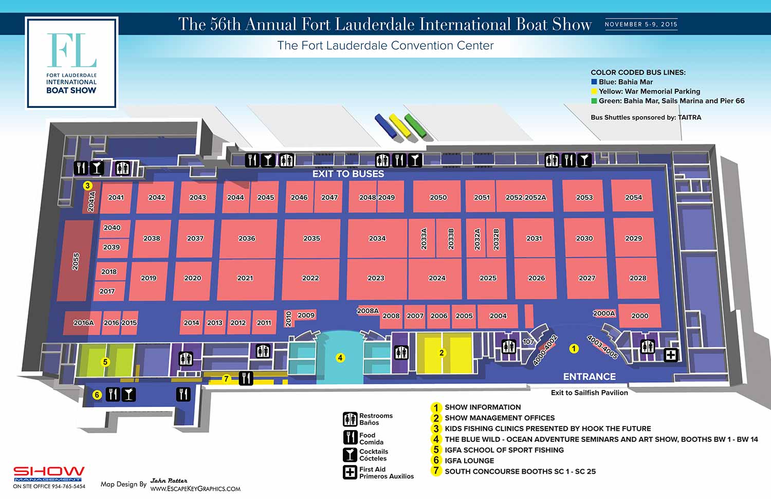
The 2015 map of the Broward County Convention Center for the Fort Lauderdale International Boat Show (FLIBS) represents a significant visual evolution. This year's illustration underwent a major redesign to achieve a cleaner, more contemporary look and feel, aligning with a renewed header design supplied by the Show Management staff. The goal was to create a more modern, stark, and focused presentation.
A key visual change was the removal of all exterior building structures from the rendering. These elements were replaced with generous white negative space, creating a sharp, uncluttered background that made the convention center layout the sole focus. The perspective was also adjusted, shifting closer to a straight overhead view and eliminating the previous 45 degree tilt. While the building's interior color scheme saw few changes, its appearance was dramatically transformed by the shift from a black to a white background, resulting in a brighter and more graphic presentation.
Consistency Within Change
Despite these substantial aesthetic updates, the map maintained its core functional systems. The color keying for complimentary shuttle transportation, the intuitive graphical icons for amenities, and the yellow dot keying for major points of interest were all retained to ensure continuity for returning attendees. As with every annual update, meticulous revisions were made to the shape and placement of exhibitor spaces, along with corresponding updates to all booth number spans.
It is noteworthy that all of these changes were executed using the same robust three dimensional digital model originally built for this application. This demonstrates the model's remarkable versatility and long term value as a foundational tool, capable of supporting major stylistic shifts without requiring a rebuild from scratch.
The Strategic Role of Event Cartography
This map was one of many created for the 2015 FLIBS, highlighting the essential need for professional navigational aids at large scale events. These illustrations serve a critical dual purpose. On site, they function as indispensable wayfinding tools, both as printed handouts and as environmental signage, directly enhancing the visitor experience.
Perhaps more importantly, they provide a powerful marketing asset in the pre event phase. While promotional materials often rely on generic stock photography, a custom illustrated map offers substantive and meaningful content. It allows an organization to promote its event with a unique piece of art that genuinely informs potential attendees about the scale, layout, and professionalism of the experience in an aesthetically pleasing and brand specific way.
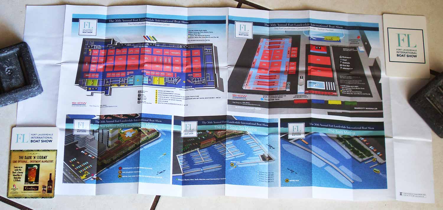
This redesigned map is part of an ongoing series. To see the detailed exterior map of the adjacent show grounds from the same year, please visit the Broward Convention Center Exterior Map 2015.
For more examples of how custom illustration serves both navigation and marketing for major events, please explore my full Maps Portfolio.
Fort Lauderdale International Boat Show Maps:
- About Fort Lauderdale International Boat Show
- Bahia Mar, Swimming Hall of Fame & Las Olas Marina Maps: 2025 | 2024 | 2023 | 2022 | 2020 | 2019 | 2018 | 2017 | 2016 | 2015 | 2014 | 2013 | 2012 | 2011 | 2010
- Parking and Transportation Maps: 2025 | 2024 | 2023 | 2022 | 2020 | 2019 | 2018 | 2015 Bus | 2015 Water Taxi | 2014 | 2013 | 2012 | 2011
- Broward County Convention Center Maps: 2025 | 2024 | 2023 | 2022 | 2017 Sailfish Pavilion | 2017 | 2016 Sailfish Pavilion | 2016 | 2015 Sailfish Pavilion | 2015 | 2014 Sailfish Pavilion | 2014 | 2013 Sailfish Pavilion | 2013 | 2012 | 2011 | 2010
- Marinas Maps: 2025 | 2024 | 2023 | 2022 | 2019 | 2016
- Program Layouts: 2025 | 2024 | 2023 | 2022
- Signs: 2013 looking north | 2013 Yachting Tent
- Video: 2013 54th Annual
- Illustrations (not maps): 2014A | 2014B
CUSTOM BOAT SHOW MAPS:


PORTFOLIOS
- Illustration Portfolio: Start here for custom illustration and book covers. You can also browse illustrated maps and architectural rendering.
- Fine Art: I offer original paintings and drawings, including my Custom Halftone Series. You will also find mural work here.
- Graphic Design & Motion: View my graphic design portfolio. After that, explore motion design and animated illustrations.
- Maps by application: I create illustrated maps for boat shows, resorts, marinas, real estate, transportation, transit and parking, towns and cities, parks, and wayfinding.
- Additional project types: I also produce cover illustration, vehicle and vinyl wraps, proposal renderings, and street art.
- Illustration methods: My techniques include vector, isometric and axonometric, painting, black and white, GeoData maps, overhead maps, and custom halftones.
- Software portfolios: I work primarily in Adobe Photoshop, Adobe Illustrator, SketchUp Pro, and Adobe InDesign. For motion projects, I use Premiere Pro and After Effects. You can watch my demo reel here.