Museum Park Map for the Miami International Boat Show - 2022
Client: Informa Markets
For information about the Miami International Boat Show and to ensure you're seeing the latest maps and information visit MiamiBoatShow.com
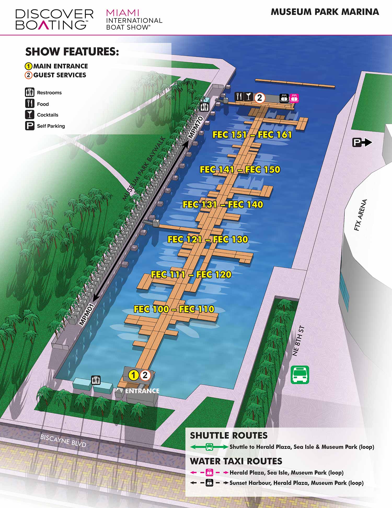
This map illustrates the marina located between the Kaseya Center, home to the Miami Heat, and Maurice A. Ferré Park (commonly known as Museum Park). The marina is notable for its lack of traditional floating docks, instead featuring side to mooring that accommodates vessels from 100 feet to over 500 feet in length. The site holds historical significance as the former location of the Port of Miami, which operated here from the early 1900s until its relocation to Dodge Island in the 1960s.
The layout of the floating docks and vessels changes each year, a logistical challenge that is efficiently managed through my working methodology. By constructing a detailed three dimensional digital model of the site, I can accurately update these arrangements with relative ease. This systematic approach proves highly effective, allowing me to work smarter. The time saved on foundational adjustments is then allocated to other event maps requiring detailed attention and custom refinement.
The map is designed for clarity and immediate use. Docks are labeled directly on the illustration, while show features and amenities are identified using a separate map key with graphical icons. The single relevant shuttle route connecting the area is explained through a simple, straightforward graphical system.
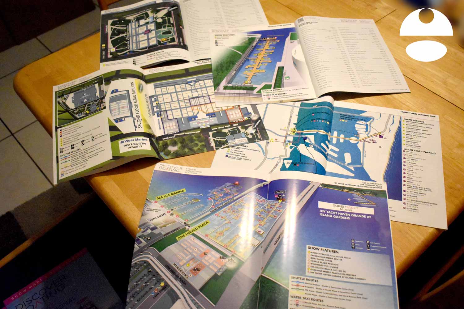
This map was produced as one of five complementary maps for the event, all of which were integrated into the official show program, including page layouts completed by me. Beyond print, the map was utilized across digital platforms, on site signage, and various marketing materials. For an event of this scale, a clear and professionally designed wayfinding map is indispensable. It serves not only as a practical navigation aid but also as a visual indicator of the event's organization, professionalism, and overall quality.
For more examples of my event graphics and venue maps, please visit my Maps Portfolio.
EXAMPLES OF MAPS CREATED FOR MIAMI BOAT SHOWS:


Miami International Boat Show Maps 2022:
Sea Isle Marina and One Herald Plaza | Museum Park | Miami Beach Convention Center Map | Transit and Parking | Pride Park | Yacht Haven Grande at Island Gardens | Program LayoutMaps For Boat Shows In Miami:
- About Miami Boat Shows
- Miami International Boat Show / Miami Yacht Show / Yachts Miami Beach / Miami Beach Yacht and Brokerage Show - Show Center/Primary Venue Maps: 2026 | 2025 | 2024 | 2023 | 2022 | 2020 | 2019 | 2018 | 2017 | 2016 | 2015 | 2014 | 2013 | 2012 | 2011
- Transportation Map: 2026 | 2025 | 2024 | 2023 | 2022 | 2020 | 2019 | 2016 | 2013 | 2012
- Program Layout: 2026 | 2025 | 2024 | 2023 | 2022
- Yacht Haven Grande at Island Gardens: 2026 | 2022 | 2020 | 2016
- Miami Beach Convention Center: 2026 | 2025 | 2024 | 2023 | 2022 | 2013 | 2012
- Sea Isle Marina Only: 2013 | 2012
- Miamarina at Bayside Only: 2013 | 2012 | 2011
- Bayfront Park: 2015
- Museum Park Marina: 2025 | 2024 | 2023 | 2022
- Illustration (not a map): 2014
- Video: 2013


PORTFOLIOS
- Illustration Portfolio: Start here for custom illustration and book covers. You can also browse illustrated maps and architectural rendering.
- Fine Art: I offer original paintings and drawings, including my Custom Halftone Series. You will also find mural work here.
- Graphic Design & Motion: View my graphic design portfolio. After that, explore motion design and animated illustrations.
- Maps by application: I create illustrated maps for boat shows, resorts, marinas, real estate, transportation, transit and parking, towns and cities, parks, and wayfinding.
- Additional project types: I also produce cover illustration, vehicle and vinyl wraps, proposal renderings, and street art.
- Illustration methods: My techniques include vector, isometric and axonometric, painting, black and white, GeoData maps, overhead maps, and custom halftones.
- Software portfolios: I work primarily in Adobe Photoshop, Adobe Illustrator, SketchUp Pro, and Adobe InDesign. For motion projects, I use Premiere Pro and After Effects.